Thursday 31 August 2017

Mooching Round the Mines at Nenthead

Over to Nenthead in the North Pennines, and the heart of the lead mineral mining area today. I was with old mate Bill, although I visit Nenthead on a fairly regular basis lots of todays walk was new to both of us. We were blessed with the weather, here's a few pictures of the day.....

Carrs Level (I think!) As I understand it, this is the entrance used for the mine tours...Approx 10 days a year....I need to get on one of these sometime!

Looking back down towards Nenthead from the entrance to Carrs level

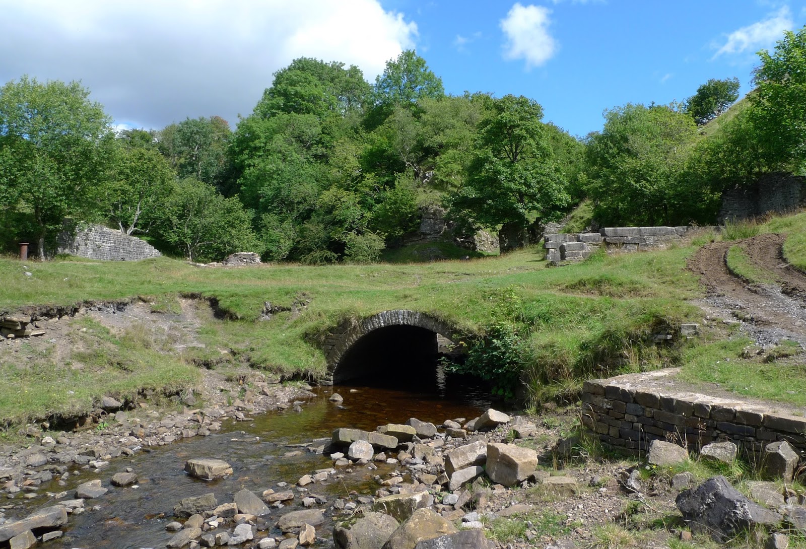
The entrance to Smallcleugh Mine and to its right the remains of the Smithy/mine shop.

Bill further up Old Carrs Burn

Mine Tub in Middlecleugh Mine

The smaller of the 2 reservoirs built to supply water to the mines

Another Level, Brownley Hill Mine

The public fountain in the centre of the village.
Hadn't they ever though about carrying a sports bottle of expensive water everywhere with them! 

Thursday 24 August 2017

An Upland Wander Above Patterdale

This was a walk which didn't trouble any summits! I was more intent on dodging the heavy showers as they were blown in on the stiff SW wind. This is always an enjoyable walk, one I have done many times....it fills in an interesting half day. Here's some pics of the day....


Looking back at Place Fell...the "Fix the Fells" path is at last starting to blend in!
Glenridding and the head of Ullswater seen across Chapel-in-the-Hause

Angletarn with Satura Crag and Rest Dodd behind.
Centre left in the picture you can see a tent....just being taken down at 11.45am! 

Another view over Angletarn...sparkling after one of the showers had passed through.

Looking down Bannerdale from Satura Crag

Back down by Hayeswater Gill.
The recent work on the Hydro scheme is blending in well here :-)

Sunday 13 August 2017

Slitt Mine, Westgate in Weardale

I've had this walk on my radar for many years, although short it's packed with interest for anyone interested in mines/industrial archaeology. We were blessed with the weather,  I should make a note that we risked life and limb by defying the warning that the path wasn't passable at the moment!
Here's a few photos of our walk...

Having parked in Westgate the path enters Slitt Wood near High Mill.
There are several small falls in the beck, nicely lit today with the sunlight through the canopy.

As you leave the wood behind (and the perils of the collapsed path) the first indication that the mine is just round the corner is this row of Bouseteams

This is the main site of Slitt mine and the next image gives an impression of how things would have looked over 130 years ago.
We had lunch here, whilst reading the information boards. It gave us time to contemplate how the tranquil air was so different to the times when the mine was in operation. 

One of the excellent information boards above the Main Shaft 177m deep (thankfully capped by a concrete slab) Imagine descending that on rudimentary wooden ladders by candlelight before you actually start work! Health and Safety....Pahh!

Continuing up the valley on what appears to be the trackbed of an old tramway we arrived at the remains of the washing floors at Middlehope Sheild.

Leaving the valley behind we made the short climb to the West to visit the West Slitt Reservoir.
 The mines would require lots of water, so many reservoirs were built throughout the North Pennines. This one is very impressive and must have required a huge amount of labour.
We walked back to Westgate and the car via field paths enjoying the views across Weardale.
Excellent, and well worth the wait.

Thursday 10 August 2017

Overnight Camp on the Summit of Coniston Old Man

Truthfully I suppose we camped approx 25m away from the summit! Ian ( @ianwood2011 ) let me know a couple of days ago that he was thinking of this trip and asked if I'd like to come along...I was thankful of the invite as motivation for a camp has been seriously lacking! We only decided to go  at 4pm, so I quickly packed and met Ian up at the moor carpark at 6pm.
It was a superb evening as we set off up the track past "The Bell"...and into the shade...


As we gained height up the "Tourist" path the views started to open up, its very familiar ground but remains a favourite.

The path passes through several areas of slate quarrying, workplaces of some of my Great uncles and Uncles.

Having stopped at Low Water to fill our bladders/bottles we were soon on the summit. Greeted by a chilly North wind we were quick to get the shelters up.

We found a couple of good pitches, although getting pegs in was a challenge! But we expected that!

Ian getting to grips with his Gatewood Tarp, it was interesting to compare it with my Deschutes.

Watching the sunset, we could just make out the Galloway coastline.

All the pictures in this post were taken with my Sony phone....And this is rather grainy!
Looking East towards Windermere, and a just past full moon

After a decent nights sleep, with barely a breeze the sunrise was nothing special. The lakes all had a blanket of mist over them.

The early sun starting to light up my tarp as I packed up. Ian was to be at work for 9am so we had to get going.


We descended over easy ground to Bursting Stone quarry (I've always known it as "Brossan Stane")
Once below the quarry the old road made for easy progress down to the Walna Scar Road and then back to the cars.

Reflections of the Old Man in the huge car park puddle.
It had been a good overnight trip, probably the best time to be on the Lakes hills at this time of year